|
Event-day information,
including map, course, and safety notes.
The original event flyer featuring
Team SOAR, the eventual Mixed winners.
 On
a sunny (or rainy) Saturday morning, December 11, On
a sunny (or rainy) Saturday morning, December 11,
31 checkpoints are set in
beautiful and rugged hills... racers pore over how
to get them all under a time limit... and then we
gather you all up and tell you to...
Get Lost!! in Henry
Coe
All
About It! |
Details
| Directions
| Entry
and Registration
All
About It!
Event
format: In a wilderness map trek,
AKA "Rogaine," teams of up to 4 people
find a number of mapped checkpoints scattered
across a wide area. Teams can plan to
visit the checkpoints in any order, and plans
may change. It may be impossible to find all the
checkpoints in the time limit, so teams will
have to plan a route that will maximize their
score. Adding to the
complexity: checkpoints will have different
point values - closer to the start, they are
worth less; the harder ones to reach tend to be
worth more. Careful if you stay out a few
minutes late - there's a penalty for each minute
overtime!
Rules of
Rogaining
Categories:
- 4 hour time
limit—teams of 1 to 4
- 8 hour time
limit—teams of 2 to 4
- Open, Masters (average
age 40+)
- Mixed, Women,
Men
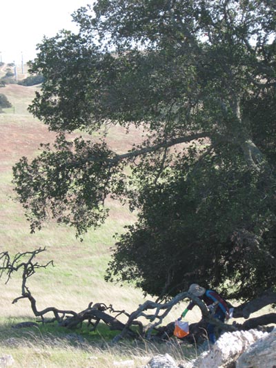
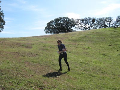
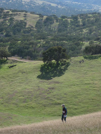
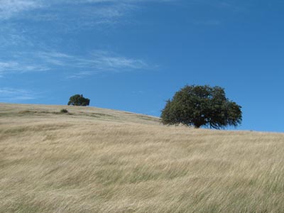
Terrain of Henry Coe
State Park: Thousands of acres of gorgeous
central coast wilderness, right in the backyard
of the Silicon Valley. An equal mix of grassland
and oak forest, most of the acreage allows for
rapid movement. What makes your route planning
interesting: steep hills (sometimes super
steep) and deep erosion features. Some poison
oak and chapparal, expanses of each are mapped.
Elevation 260 to 810 meters - in the higher
reaches you may encounter pine forest. Some
roads and trails. Views out to the ocean on a
clear day.
 Course:
An optimal route to get all the checkpoints
would be about 32 km distance "as the crow
flies." It will be possible for experienced, fit
teams to get all checkpoints in 8 hours with
perfect planning and under ideal
conditions. Course:
An optimal route to get all the checkpoints
would be about 32 km distance "as the crow
flies." It will be possible for experienced, fit
teams to get all checkpoints in 8 hours with
perfect planning and under ideal
conditions.
Map: A new survey
from lidar data, high-resolution photos, and
original 2010 fieldwork. Not just a
USGS topo! About 40 square kilometers at a
scale of 1:30,000, 10 meter contour interval,
high-legibility printing.
Refueling: A
few key checkpoints will have water. Everything
else will be at the start and finish, including
the post-event smorgasbord—nice, hot, and
filling food with vegetarian options.
Details
 Schedule: Schedule:
- 7:00 A.M. Maps
available for all teams
- 7:40 A.M. Briefing, 8
hour teams
- 8:00 A.M. Start, 8
hour teams
- 9:40 A.M. Briefing, 4
hour teams
- 10:00 A.M. Start, 4
hour teams
- 2:00 P.M. Finish, 4
hour teams
- 2:15 P.M. Search and
Rescue initiated, 4 hour teams
- 4:00 P.M. Finish, 8
hour teams
- 4:15 P.M. Search and
Rescue initiated, 8 hour teams
- 5:00 P.M.
Awards
- 6:00 P.M. Party
over!
Required
Equipment:
- Shoes with good
traction
- Clothing appropriate
to weather conditions
- Compass
- Personal hydration
system
- Snacks with salt and
electrolytes
- First-aid kit (one per
team)
- Time-keeping device
(watch or similar)
Optional
Equipment:
Banned
Equipment:
- GPS with detailed
display
Directions
The event will be staged from the Coyote Creek
Entrance to Henry Coe State Park. However, we have not obtained permission
to park inside the entrance (there is a conflict with another group of park users,
which has a higher priority). Parking is very limited outside this entrance. The
neighboring entrance, Hunting Hollow, has a very large lot and can accommodate
everyone. Please consult this page for plans and
instructions.
The directions come from
this page, which also has a
map.
The Coyote Creek entrance is
located on Gilroy Hot Springs Road, the same road you take to get to
Coyote Reservoir. To get to the entrance, take Highway 101 to Gilroy
(which is about 10 miles south of Morgan Hill and 25 miles
south of San Jose). The distance from 101 to the Hunting Hollow entrance
is about 9 miles, and the distance to the Coyote Creek entrance is
about 10.8 miles.
Take the Leavesley Road exit (County Road G9) and head east.
After about 1.8 miles, turn left (north) on New Avenue; go a little
over half a mile and then turn right (east) on Roop Road. About
3.3 miles up Roop Road, you'll pass the Coyote Reservoir Road on the
left.
The Hunting Hollow entrance is about 3.3 miles past the Coyote
Reservoir Road turnoff, and the Coyote Creek entrance (at road's end)
is about 1.8 miles from the Hunting Hollow entrance.
Entry and Registration
4 hour event |
Individual |
Team |
|
Enter and pay on or before Monday 29 November
|
$40 |
$75 |
|
Enter and pay on or before Monday 06 December
|
$50 |
$95 |
|
Enter and pay on or after Tuesday 07 December
|
$65 |
$125 |
|
|
|
8 hour event |
Individual |
Team |
|
Enter and pay on or before Monday 29 November
|
$65 |
$120 |
|
Enter and pay on or before Monday 06 December
|
$75 |
$140 |
|
Enter and pay on or after Tuesday 07 December
|
$90 |
$170 |
 There is a $5 discount offered to members of BAOC
and Orienteering USA, cumulative. That is,
someone who is a member of both can take off $10. The discounts only apply to individuals, not teams. That is,
a registration for two people who are both BAOC and Orienteering USA members will cost less than the team price. A
three-person team is always best off taking the team deal. There is a $5 discount offered to members of BAOC
and Orienteering USA, cumulative. That is,
someone who is a member of both can take off $10. The discounts only apply to individuals, not teams. That is,
a registration for two people who are both BAOC and Orienteering USA members will cost less than the team price. A
three-person team is always best off taking the team deal.
Go register!!
|